Other Protections and Initiatives
Legal and Voluntary
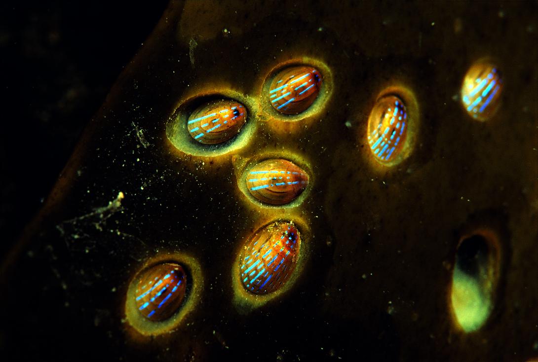
Photo credit Devon Wildlife Trust
In addition to the designations that make up the MPA, there are a range of other types of protections, both legal and voluntary, around Plymouth Sound and Estuaries which help to look after our amazing environment and to encourage people's understanding, appreciation and stewardship of the Ocean.
Plymouth Sound National Marine Park
The Plymouth Sound National Marine Park (PSNMP) is the first of its kind in the UK when it was declared in 2019. The waters and coastline are already an MPA, the PSNMP provides no additional legal protections but strives to work together with partners and communities to connect people to the marine environment.
The PSNMP supports conservation management by finding ways to manage our ecologically important and protected seascape by celebrating our local culture, and natural and historical environment. Importantly, the PSNMP seeks to foster an understanding and appreciation for its unique and important qualities, address inequalities in water access. This provides a valuable and new mechanism to assist the delivery of the Tamar Estuaries Management Plan.
The PSNMP has recently been awarded funding from the National Lottery Heritage Fund Horizons Projects. The PSNMP Horizons is a 5 year project that aims to increase access to and connect people with all aspects of marine heritage - cultural, natural and built. Providing a launch of the park in the sea.
Read more about PSNMP and how it came about under governance.
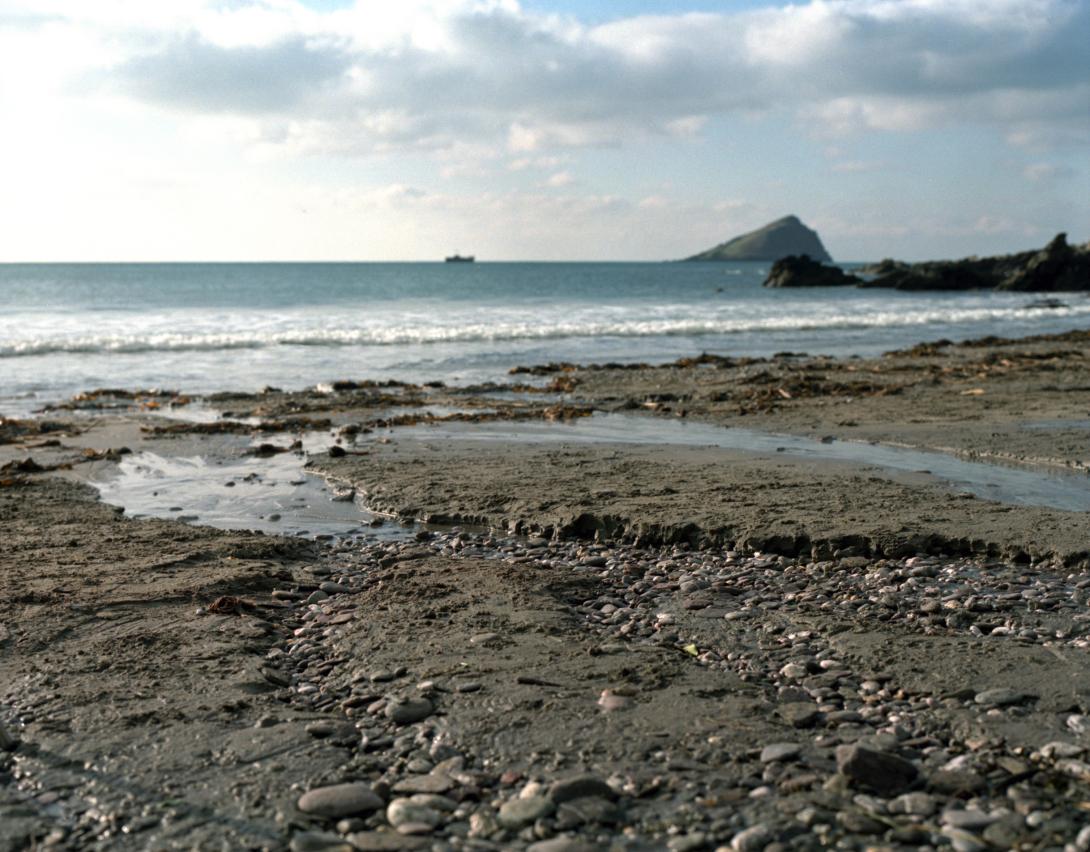
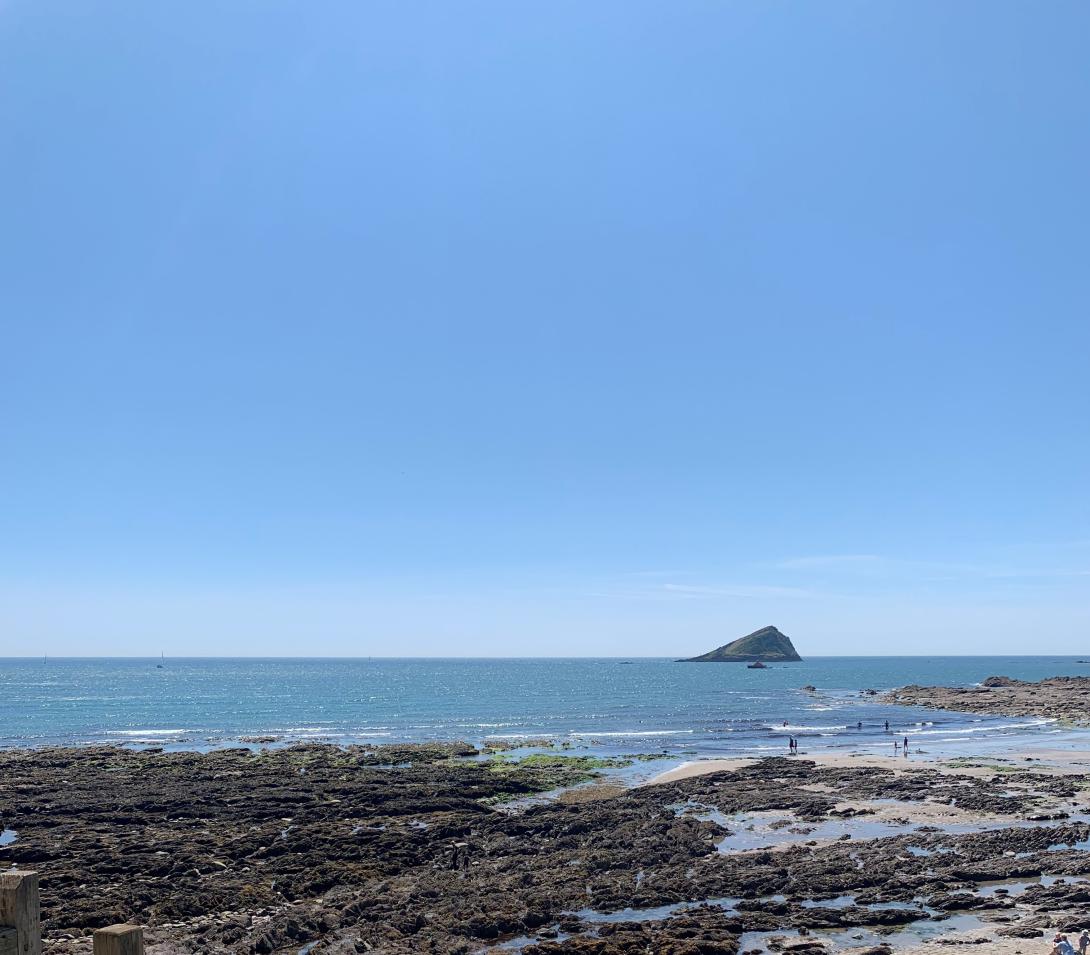
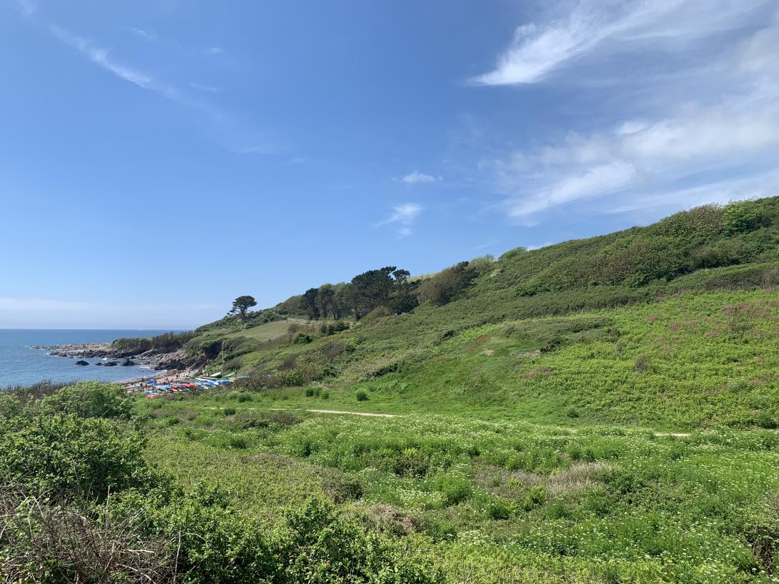
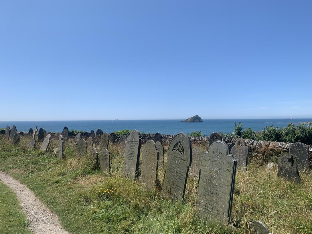
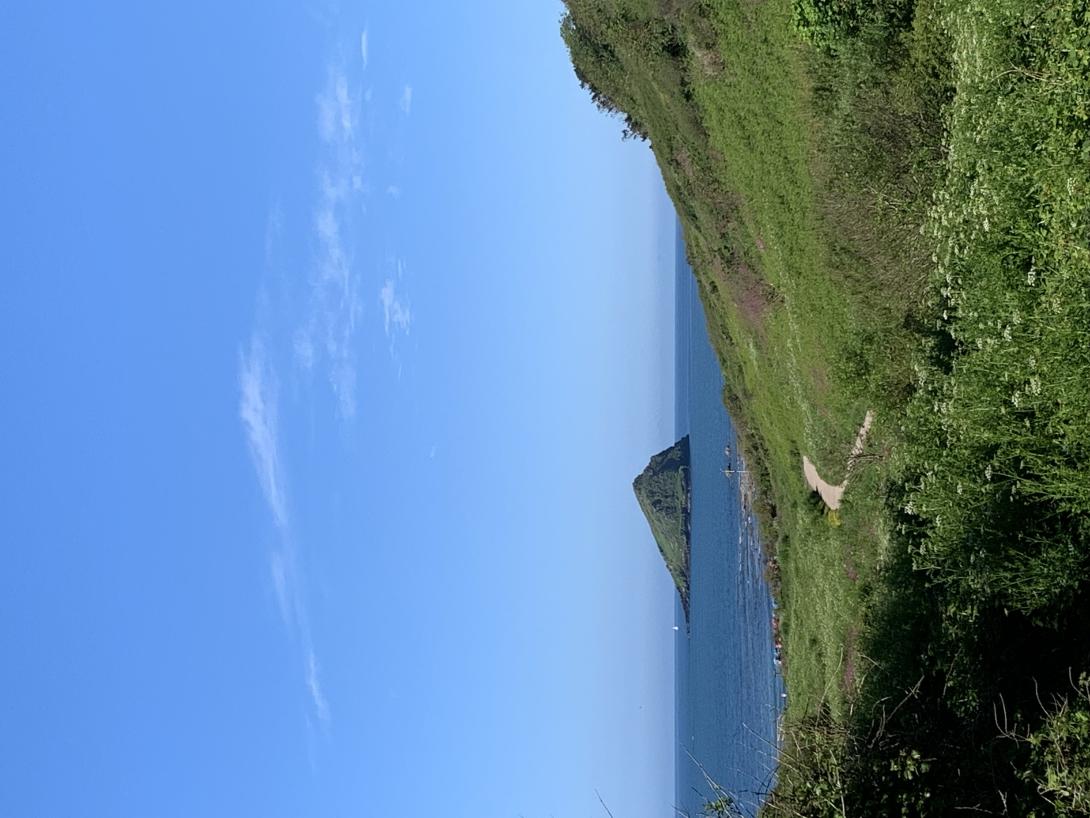
Wembury Voluntary Marine Conservation Area
The Wembury Voluntary Marine Conservation Area (WMCA) was established in 1981 in recognition of the incredible habitats and species that can be found along the coast, and the waters around the area.
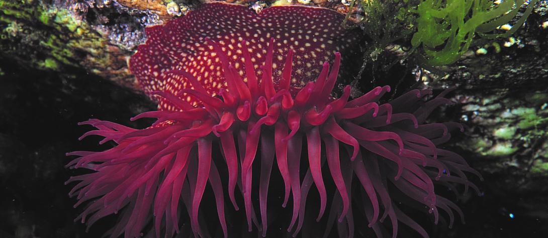
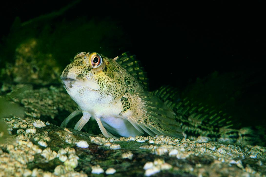
The Wembury MCA extends to 563ha from Fort Bovisand to Gara Point and seaward to include the Great Mewstone. It contains extensive and highly biodiverse rocky reefs (intertidal and subtidal), seagrass beds and sediment communities. At low water, the patches of sand, shingle and stranded seaweed provide feeding grounds for resident and migrant waders. Wembury MCA has a national and international reputation for marine biology research, including studies on rocky shore ecology, subtidal habitats, shallow-water fish species and Nursehound Catshark (Scyliorhinus stellaris) breeding grounds.
Its long-standing research role also makes the Wembury MCA an important site for the examination of long-term environmental impacts including climate change. Additional protected species of interest include the Giant Goby (Gobius cobitis) and the Pink Sea Fan (Eunicella verrucosa).
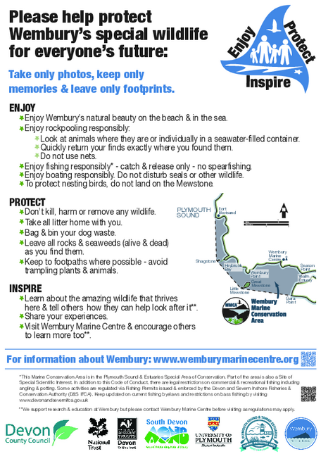
Whilst included within the legal designations such as the SAC and SSSIs, the Wembury MCA seeks to provided further protection to the marine environment by asking the no wildlife is killed, harmed or taken from the within the area. A Code of Conduct has been produced to help people understand how to enjoy and conserve the area.
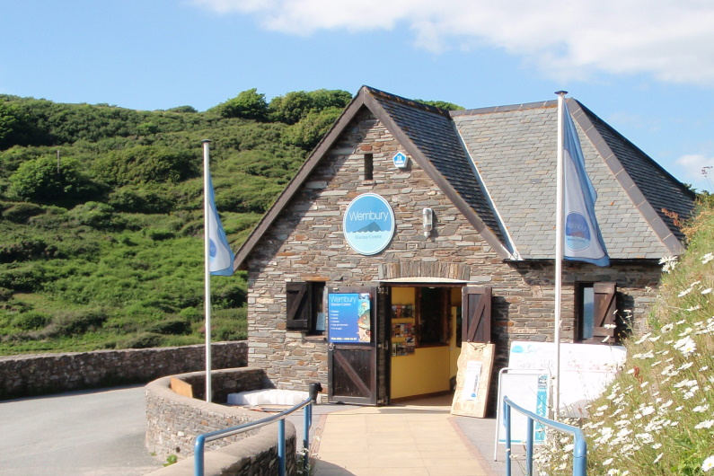
The Wembury Marine Centre is run by the Devon Wildlife Trusts and helps to support and deliver educational and engagement efforts for locals, visitors and schools.
National Landscapes

South Devon National Landscape
South Devon Area of Outstanding Natural Beauty, which were recently renamed as a National Landscapes, is an area of magnificent coastline, with dramatic cliffs and sandy coves, rivers, streams and estuaries, met by vast farmland, charming villages, wooded valleys, and ancient routeways.
Alongside its breath-taking natural features, biodiverse habitats and wildlife, the area has a wealth of historical features and practices that are intertwined with people’s way of life both in the past and present. It also has significant recreational importance and links 96km of the South West Coastal Path with people enjoying the space for a variety of reasons and activities.
Being awarded the National designation in 1960, South Devon National Landscape extends from just outside Plymouth all the way round to Torbay and is managed locally. With farming as a vital part of the economy of this area, alongside tourism and fishing, the South Devon National Landscape team work closely in partnership with local authorities, organisations and rural communities, to ensure sustainable approaches to land management and that the special qualities for which it is recognised are protected and enhanced for the benefit of nature and people.
Find out more about the area and what goes on by visiting their website.
The Tamar Valley National Landscape
The Tamar Valley National Landscape covers areas of Devon and Cornwall, and includes the lower valleys of the Tamar, Tavy and Lynher. Designated in 1995, it is one of few National Landscapes (formally Areas of Outstanding Natural Beauty) that encompasses valley and water landscapes, with rivers, estuaries to the sea, extensive wetlands (reedbeds and saltmarshes) and mudflats as well as ancient woodlands and hedge banks, rolling hills with rocky outcrops, heathland and ‘traditional’ countryside.
A spectacular haven for unique flora and fauna, the area is also famous for its rural and industrial history reflecting the changes over time, combined with rich cultural importance.
The Tamar Valley National Landscape team work together with other organisations, local authorities and communities to help conserve and enhance this special place and the people and wildlife that live there, through a range of initiatives and projects that will help the area thrive.
Find out more about the area and what goes on by visiting their website.
Site of Special Scientific Interest (SSSI)
In addition to the marine designations that make up the MPA there are also areas of Special Scientific Interest (SSSI) throughout the site.
SSSI’s are designated under the Wildlife and Countryside Act 1981 (legislation.gov.uk)protecting areas of land and water which represent the best examples of natural heritage in the United Kingdom.
These can be designated based on ‘features of interest’ that are special and/or rare and can be based on individual plants or animals, to entire habitats and often include geological features of national or historical importance.
The Lynher Estuary SSSI is 673 ha and covers the entirety of the Lyhner and overlaps with the SAC, SPA and MCZ. It is made up of principally intertidal sediment and a small area of woodland on the southern side.
The Plymouth Sound Shores and Cliffs SSSI is 44 ha and covers the shore and some of the coastal cliff from; Mt Batten to Crownhill Bay; eastern Cawsands Bay, Penlee Point and Hooe Lake Point. The shore area is also designated under the SAC. The site is made up of principally shingle and rocky shore and the cliffs are designated for the geological interest.
The Rame Head SSSI is 161 ha and covers the upper shore (supralittoral zone) and coastal cliffs around the headland and Polhawn Cove. The area covering Polhawn Cove is also designated under the SAC. The site is made up of principally coastal cliffs of geological interest and coastal plants
The St. John’s Lake SSSI is 266 ha and covers the intertidal area of St Johns Lake and overlaps in its entirety with the SAC and SPA. It is made up of intertidal sediment.
The Tamar-Tavy Estuary SSSI is 1,414 ha and covers the coastline from Heybrook main estuary areas down to the Tamar Bridge and the shore area overlaps in its entirety with the SAC. It is made up of principally intertidal and subtidal sediment, saltmarsh and some areas of fringing woodland.
The Wembury Point SSSI is 139 ha and covers the shore and some of the lower estuary rocky shore and the intertidal areas in the upper estuary, excluding conflate creek. It overlaps in its entirety with the SAC. The site is made up of principally rocky shore, upper shore (supralittoral zone), and the fringing cliffs and fields designated for the coastal vegetation and woodland.
The Yealm Estuary SSSI is 87ha and covers some of the intertidal area main estuary areas down to the Tamar Bridge. The shore area overlaps with the SAC. It is made up of principally intertidal rock and sediment.
For more detailed information, guidance and conservation advice visit Natural England Designated Sites View (naturalengland.org.uk)